Integration of Urban Green and Blue Infrastructure by Means of an Interactive and Geo-spatial Webmap-Tool
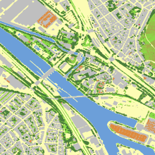
As a contribution to the nationally funded project INTERESS-I, we developed a web-based tool that balances rain and grey water drainage on the one hand, and vegetation water demand on the other. The tool combines GIS-balances of rain and grey water harvest in a catchment area and a day-by-day calculation of water demand from different vegetation structures respective of local weather history, shading situation and soil water conditions. The tool shows the drought period length a specific water storage volume can bridge.
For more details, we invite you to follow the provided link or download the accompanying PDF file.
| Contact |
|---|